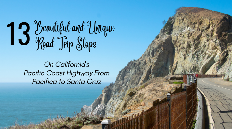
California’s Pacific Coast Highway (PCH), is one of America’s most spectacular and popular bucket list road trips for a reason. This famous and iconic (part rocky coast hugging 2-lane road, part highway through quaint towns, and 100% jaw dropping beautiful mountains-meets-deep-blue-ocean) stretch of road between San Francisco and Los Angeles is everything that the hype has made it out to be.
While there are many sections of PCH that will have you signing “California Dreaming” at the top of your lungs, the drive beginning in the town Pacifica, which is just a short 15 minutes south of San Francisco, to Santa Cruz provides plenty of awestruck views and is worth allotting a day’s drive to explore a few noteworthy spots.
The scenic 62-mile drive from Pacifica to Santa Cruz takes approximately 1 hour and 40 minutes without any stops. While it can be thrilling just to enjoy an uninterrupted journey down the coast hugging highway, if this is your first time driving this stretch of PCH, trust me, you will want to carve out time in your travel itinerary to take in the unique beauty that can only be found in this part of California’s coastline. I would realistically plan 3 to 4 hours or more for the trip depending on how many places you want to see, how long you want spend in any one place, and whether you are planning on stopping for lunch along the way.
The list of the places we stopped at is just only a handful of the many pit stops you will have to choose from on your road trip through this stretch of PCH. Although I wanted to see and do as much as I could, I had to regrettably skip a few recommended stops, as pulling over at every dreamy beach overlook and hiking the many trails on my list was not feasible with only so many hours in a travel day.
So what should you see and where should you stop along this iconic California highway? Check out a few highlights from our journey. Stop at all or just a few, as there is no wrong or right way to explore California’s Pacific Coast Highway.
Pacifica State Beach/Taco Bell Beach
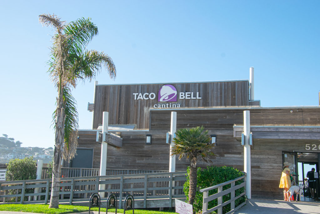
OK, before you start questioning why would anyone want to stop at a Taco Bell when there is so much natural beauty that lies ahead on your journey, let me tell you why — it happens to be the most scenic Taco Bell in the world.
Pacifica Beach’s Taco Bell is a landmark sitting directly on the beach with plenty of free parking. Just look for this place and you will know you have arrived at Pacifica Beach State Park. The deck out back is the perfect place to eat a quick snack and relax with the ocean breeze and the sounds of the waves crashing on the shore. It’s also a great place to watch the local surfers in action.
Devil’s Slide Trail
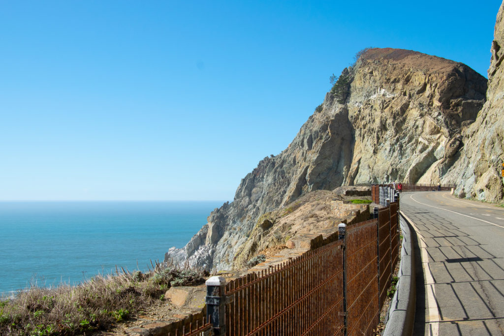
Just a short drive south and you will come to Devil’s Slide Trail. There is both a north entrance and a south entrance with parking on either side of the tunnel that divides the trail into two areas along PCH. Devil’s Slide gets its name from the portion of PCH that was closed and re-routed in 2013 due to the dangerous rock slides that plagued this stretch of highway. Today, visitors can walk or bike the old highway and its 1.3 miles of trails for spectacular views of the Pacific Ocean. This is one of the more unique trails to discover on this trip.
Graffiti Hill/Devil’s Slide Bunker
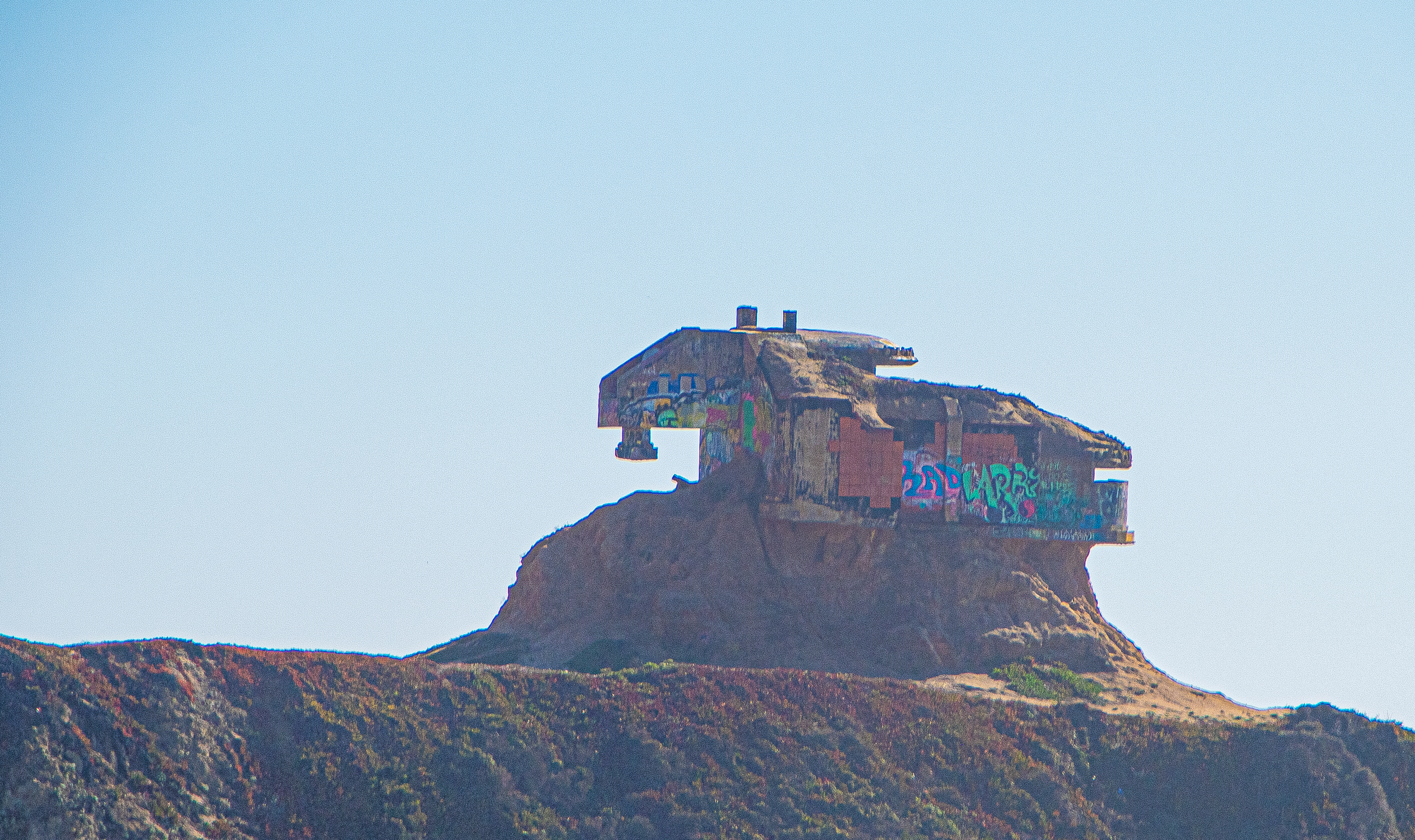
Less than one mile south of Devil’s Slide Trail is where you will find this abandoned WWII military bunker. Perched precariously atop of a rocky mound, Graffiti Hill sits on privately owned land and is technically not open to the public, but that has not stopped numerous graffiti artists from putting their mark on this unique place. If you are weary of having to hike your way up to it and navigating around the fence perimeter, you can view it from a distance from the south entrance of the Devil’s Slide parking lot.
JV Fitzgerald Marine Reserve
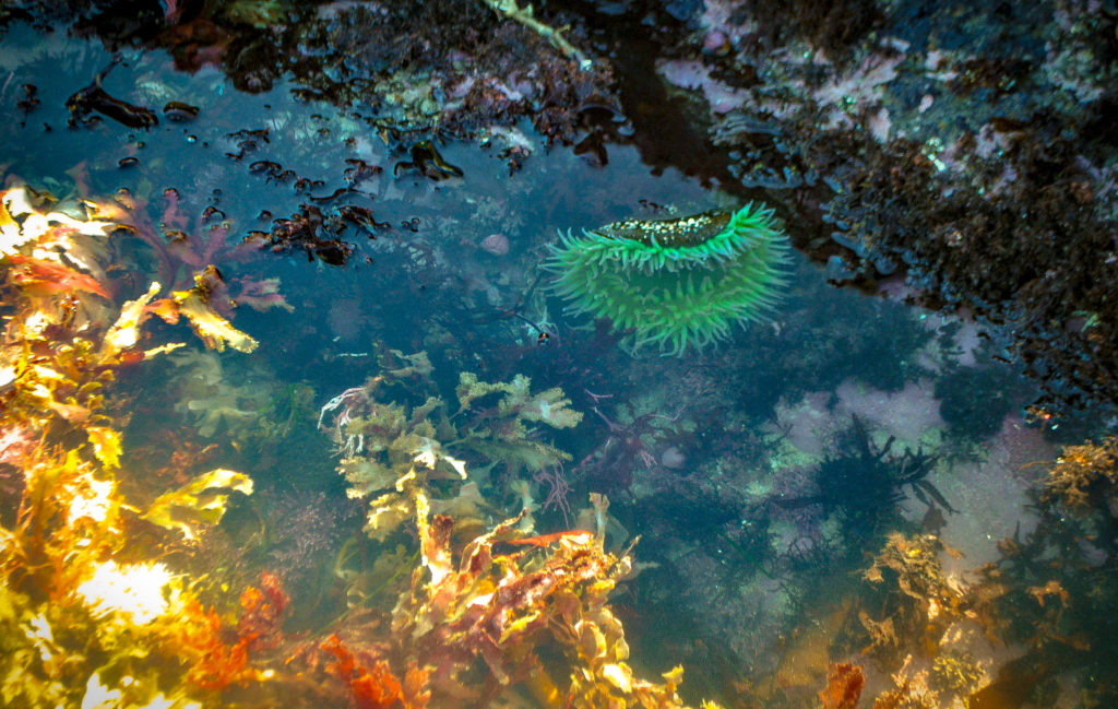
Just a short 7 minute, 3.7 mile drive from Devil’s Slide Trail and you will come to JV Fitzgerald Marine Reserve. While there are numerous beautiful beach breaks along your drive worthy of spending a bit of time at, this stop is unique in the fact that it is an intertidal zone where you are treated to a mesmerizing display of colorful sea creatures as you walk among the tide pools that are exposed during low tide.
JV Fitzgerald Marine Reserve is a three-mile stretch of rocky coastline that is located just north of Moss Beach.
Mavericks Beach
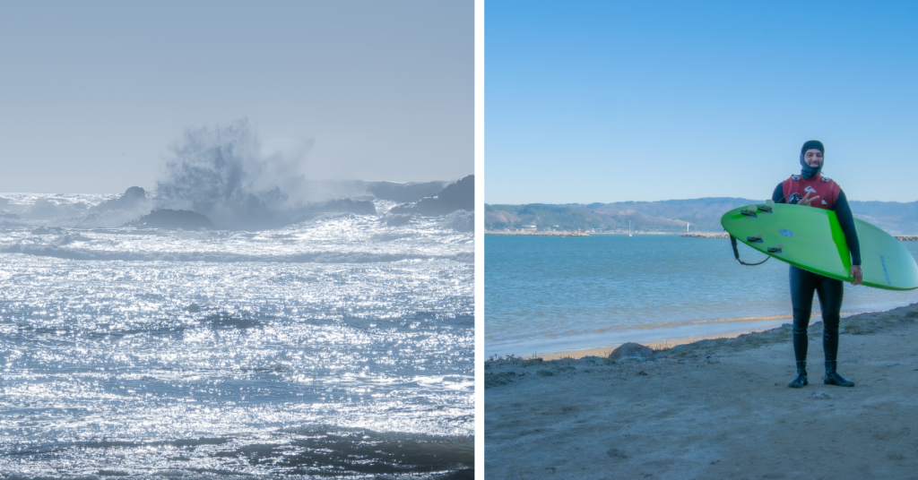
Our next stop brought us to Mavericks Beach, one of the big wave surfing meccas of the world. As my husband is a surfer, this was a must see on our road trip. Look for the famous “golf ball” tower that sits atop of the bluffs as your landmark.
To reach Mavericks Beach, you will need to park in the West Point parking lot in Princeton and walk the 1/2 mile bluffs trail which will lead you around the corner to the beach. If you are visiting during the big wave surfing season, you might be able to witness a few daring surfers paddling out. We had the pleasure of meeting a local surfer (pictured above) during our trip.
Pillar Point Harbor
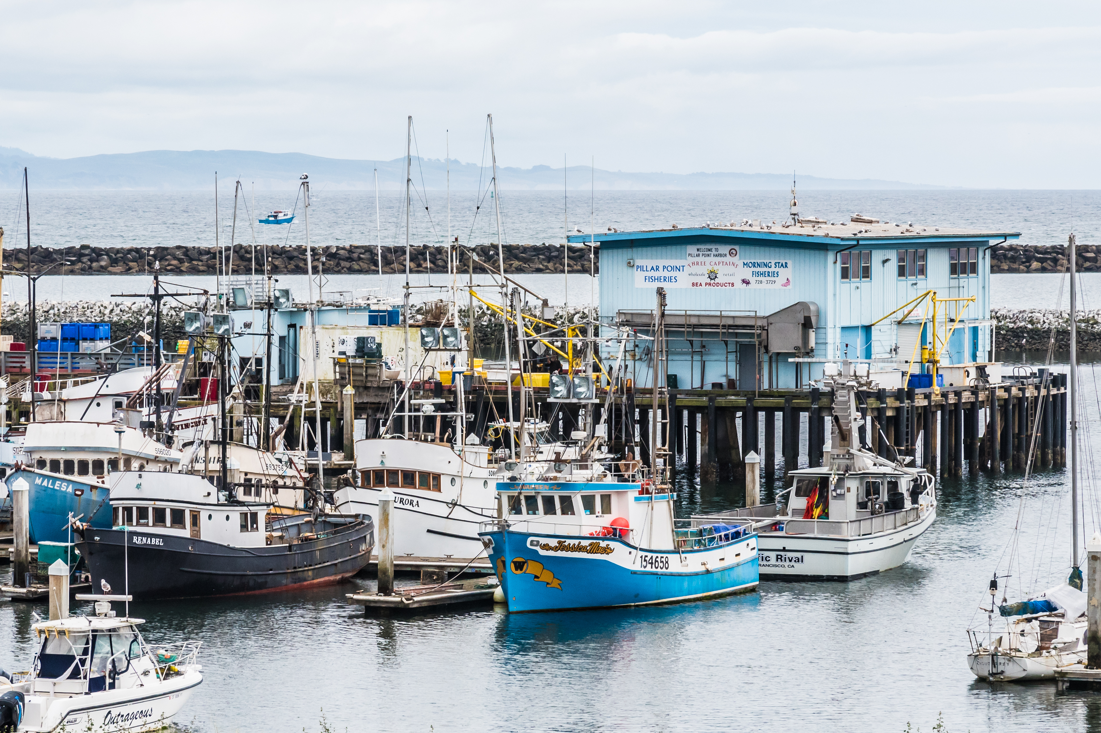
After vising Mavericks Beach, we continued our journey past Pillar Point Harbor, the only protected harbor between San Francisco and Santa Cruz. Pillar Point Harbor with its 300+ boat slips is home to commercial and sports fisherman, as well as a few restaurants and shops such as Mavericks Surf Shop. You can also fish off the Johnson pier or rent a kayak if you have the time. It’s a wonderful place to take in the rustic charm and views of the bay.
Half Moon Bay
While I don’t have a picture to share of this charming beachside town, this is the perfect place to stop for lunch. You may choose to eat at the famous Sam’s Chowder House with its magnificent views of the harbor, take a break at the Half Moon Distillery, or head into town and take a pick of the many establishments on Main Street.
California Coastal Trail at Ritz Carlton
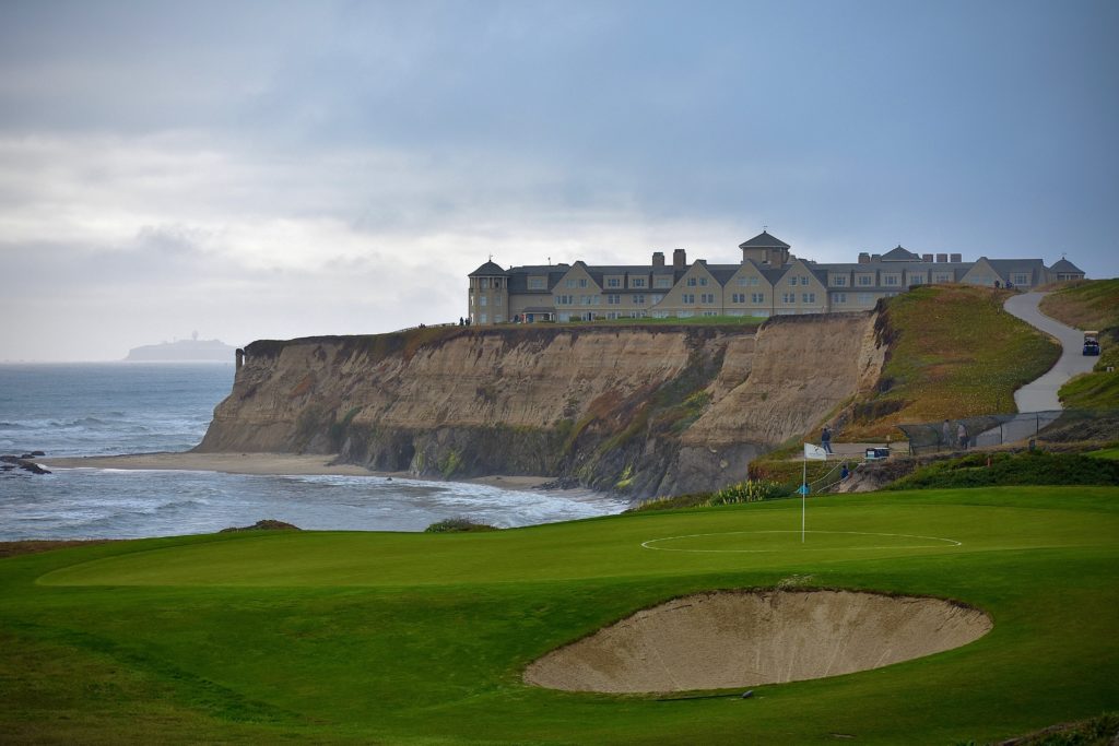
The California Coastal Trail is part of an expansive interstate trail network spanning 1,230 miles from Oregon to Mexico. The stretch that runs through Half Moon Bay from Miramar Beach to just south of the Ritz-Carlton is a favorite segment for those visiting the area. If you just want to experience a small sampling of the trail, park near the Ritz-Carlton (there are 15 free spaces available) for an easy walk along the trail with spectacular views of the rugged coast line.
Bean Hollow State Beach
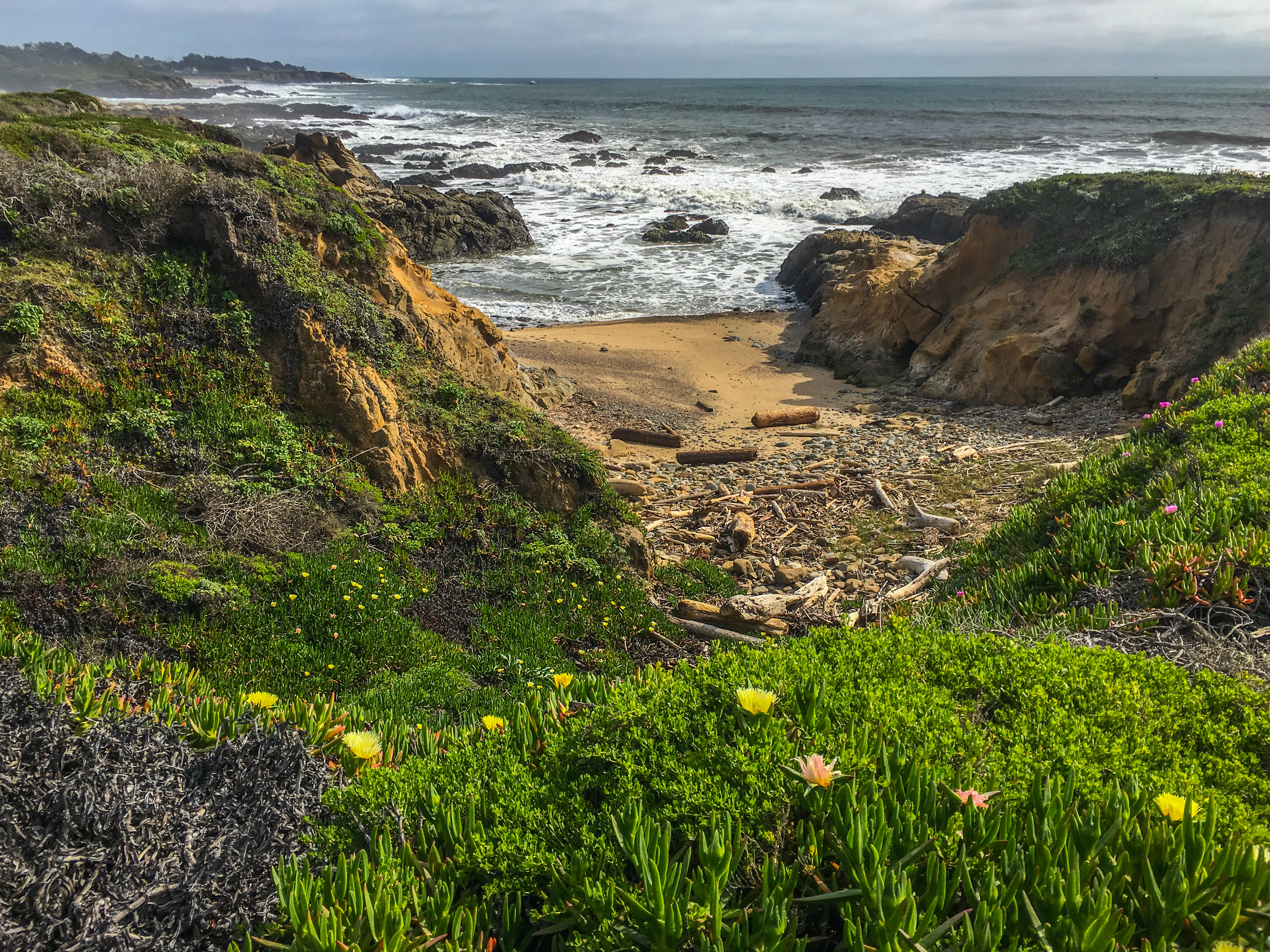
Continuing south towards Santa Cruz, there are several world class beaches to stop and enjoy the gorgeous views of the Pacific Ocean (Martin’s Beach, San Gregorio State Beach, Pomponio State Beach, and Pescadero Beach Park to name a few). We chose Bean Hollow State Beach as it was the perfect driving distance from Half Moon Bay to enjoy a quick pit stop without feeling like we were pulling over every 2 minutes at every beautiful beach (which is easy to do when the ocean views are mesmerizing).
Bean Hollow State Beach sits between two protected coves and is one of the few state beaches that permit dogs. Take the one-mile stroll on the nature trail to see wild flowers, tide pools, and a colony of harbor seals.
Pigeon Point Lighthouse
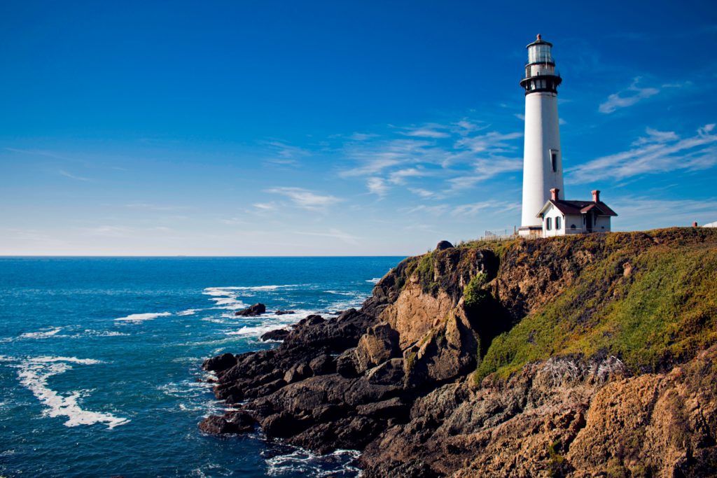
Our next stop was at Pigeon Point Lighthouse, the tallest lighthouse on the West Coast of the U.S. Built in 1871, the 115-ft structure is the most photographed lighthouse in California. Parking is free and there is a hostel on site for those wanting to spend the night.
Ano Nuevo State Park
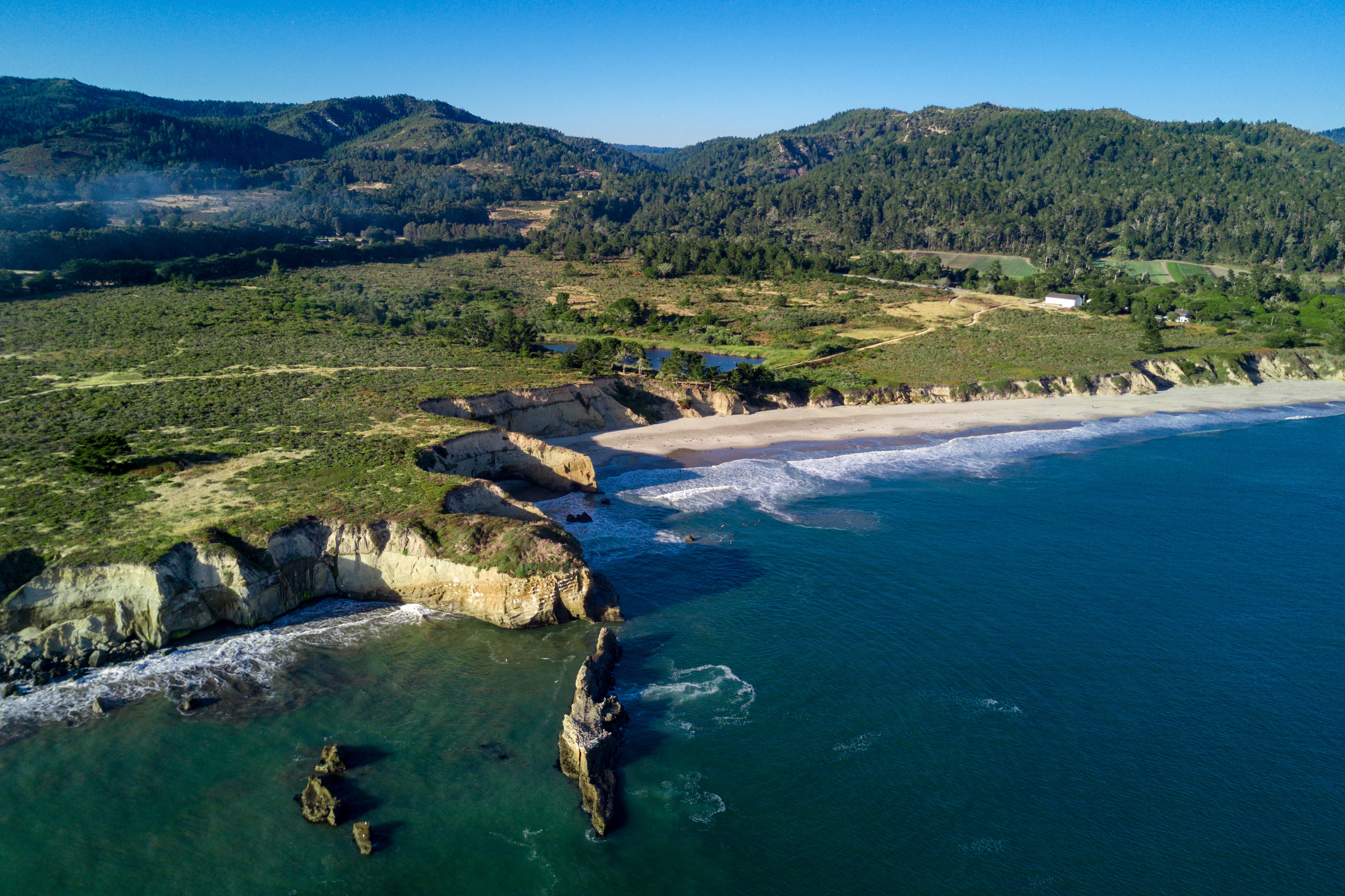
Drive another 10 minutes south and you will come to Ano Neuvo State Park. While parking will cost $10 per car, the park will offer you the opportunity to see elephant seals, sea lions and numerous bird species including the bald eagle. There is a bit of a hike from the parking lot to the beach, but the beautiful unspoiled views of the Pacific Ocean and animal encounters are your reward.
Shark Fin Cove
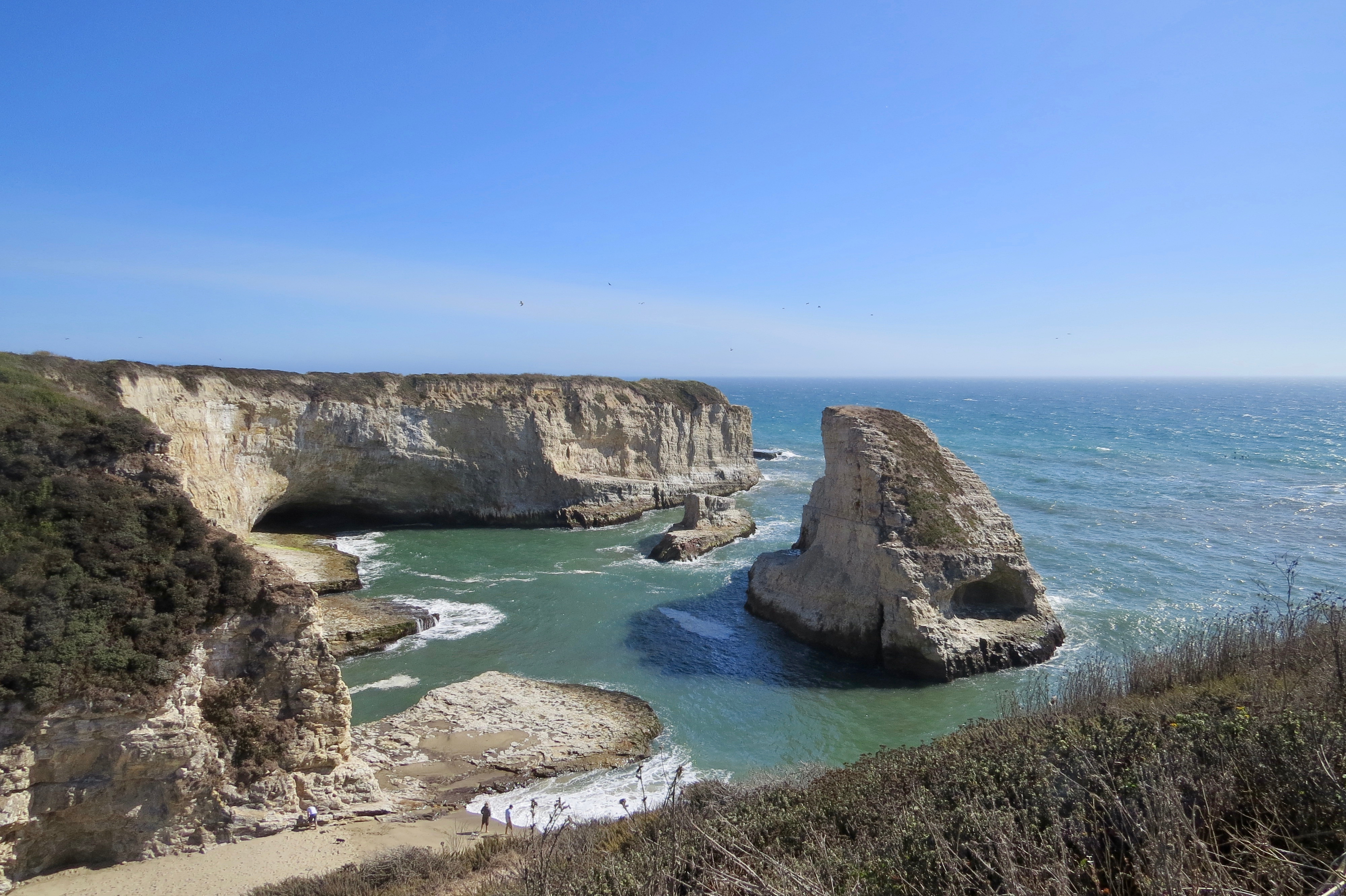
As your journey south brings you closer to Santa Cruz, be one the look out for Shark Fin Cove. It’s very easy to miss as there is relatively no official parking and no marker sign (I would use Google Maps to help you find it). The name comes from the unique shape of the rock jutting out from the center of the cove. Tip: wear sturdy shoes as the hike down to the cove is unpaved and a bit rocky.
Natural Bridges State Beach
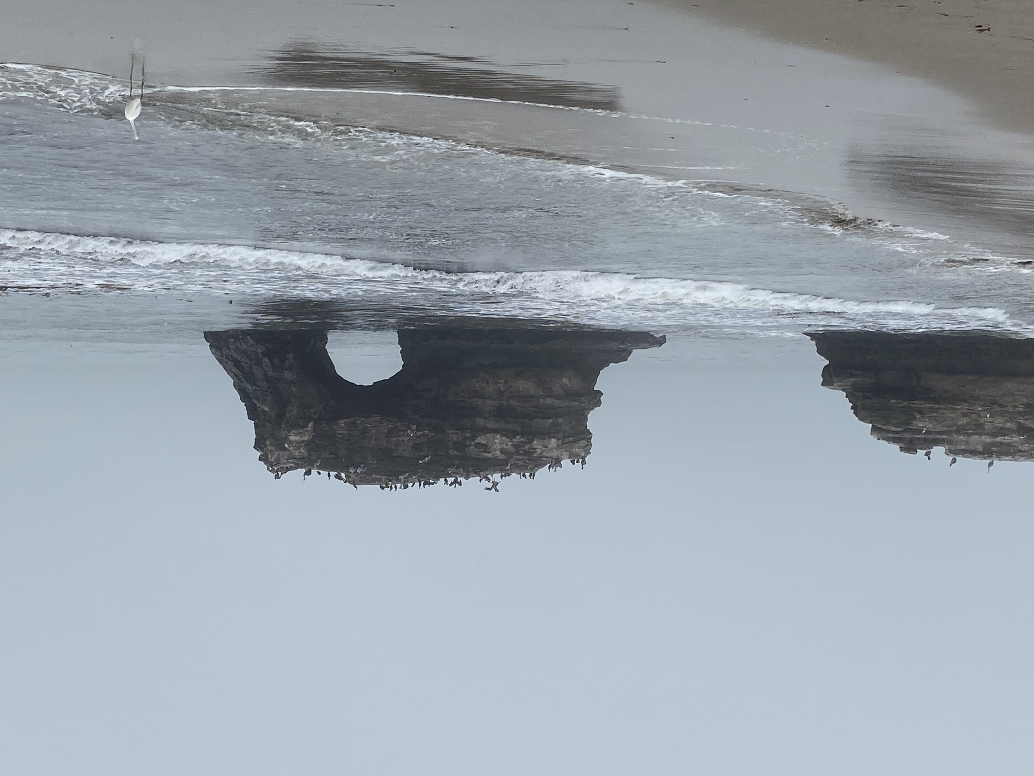
The last stop before we reached our destination hotel in Santa Cruz, was a quick stop at Natural Bridges State Beach. There is a small parking lot with limited free parking where you can view the arched rock formation from the cliff or you can walk into the park and then down the slight grade embankment to the shore line (that is what we did). If you are visiting during the winter months and have more time and better weather then we did, make sure you check out the Monarch Trail where you will be able to see the annual migration of Monarch butterflies.
As I mentioned previously, I had to cut a few stops out of my original plans due to time limitations. However, if you have more time to explore, here are a few other noteworthy places to see: Wild Mustard Farm, Pescadaro State Beach Park, Arcangeli’s Grocery Co, (famous for its artichoke bread), Pie Ranch, and Harley’s Goat Farm.
If you have taken a road trip on this portion of Pacific Coast Highway, what were your favorite places to stop at and why? I’d love to visit them on my next trip to the area.
1 Comment
This sounds like an amazing trip. I would love all of these places. Thank you for sharing your trip.